LiDAR-RT: Gaussian-based Ray Tracing
for Dynamic LiDAR Re-simulation


Chenxu Zhou1*  Lvchang Fu2*  Sida Peng1   Yunzhi Yan1   Zhanhua Zhang3   Yong Chen3   Jiazhi Xia2   Xiaowei Zhou1

1Zhejiang University     2Central South University     3Geely Automobile Research Institute
*Equal Contribution

Abstract


Realistic and real-time rendering of LiDAR view in dynamic driving scenes. Our LiDAR-RT produces high-fidelity LiDAR view at 30 FPS (64×2650) within 2 hours of training. SOTA method struggles to model the dynamic objects in complex scenes and suffers from high training and rendering costs (15 hours for training and 0.2 FPS for rendering a range image).

This paper targets the challenge of real-time LiDAR re-simulation in dynamic driving scenarios. Recent approaches utilize neural radiance fields combined with the physical modeling of LiDAR sensors to achieve high-fidelity re-simulation results. Unfortunately, these methods face limitations due to high computational demands in large-scale scenes and cannot perform real-time LiDAR rendering. To overcome these constraints, we propose LiDAR-RT, a novel framework that supports real-time, physically accurate LiDAR re-simulation for driving scenes. Our primary contribution is the development of an efficient and effective rendering pipeline, which integrates Gaussian primitives and hardware-accelerated ray tracing technology. Specifically, we model the physical properties of LiDAR sensors using Gaussian primitives with the learnable parameters and incorporate scene graphs to handle scene dynamics. Building upon this scene representation, our framework first constructs a bounding volume hierarchy (BVH), then casts rays for each pixel and generates novel LiDAR views through a differentiable rendering algorithm. Importantly, our framework supports realistic rendering with flexible scene editing operations and various sensor configurations. Extensive experiments across multiple public autonomous driving benchmarks demonstrate that our method outperforms state-of-the-art methods in terms of rendering quality and efficiency. Our code will be made publicly available.

Method


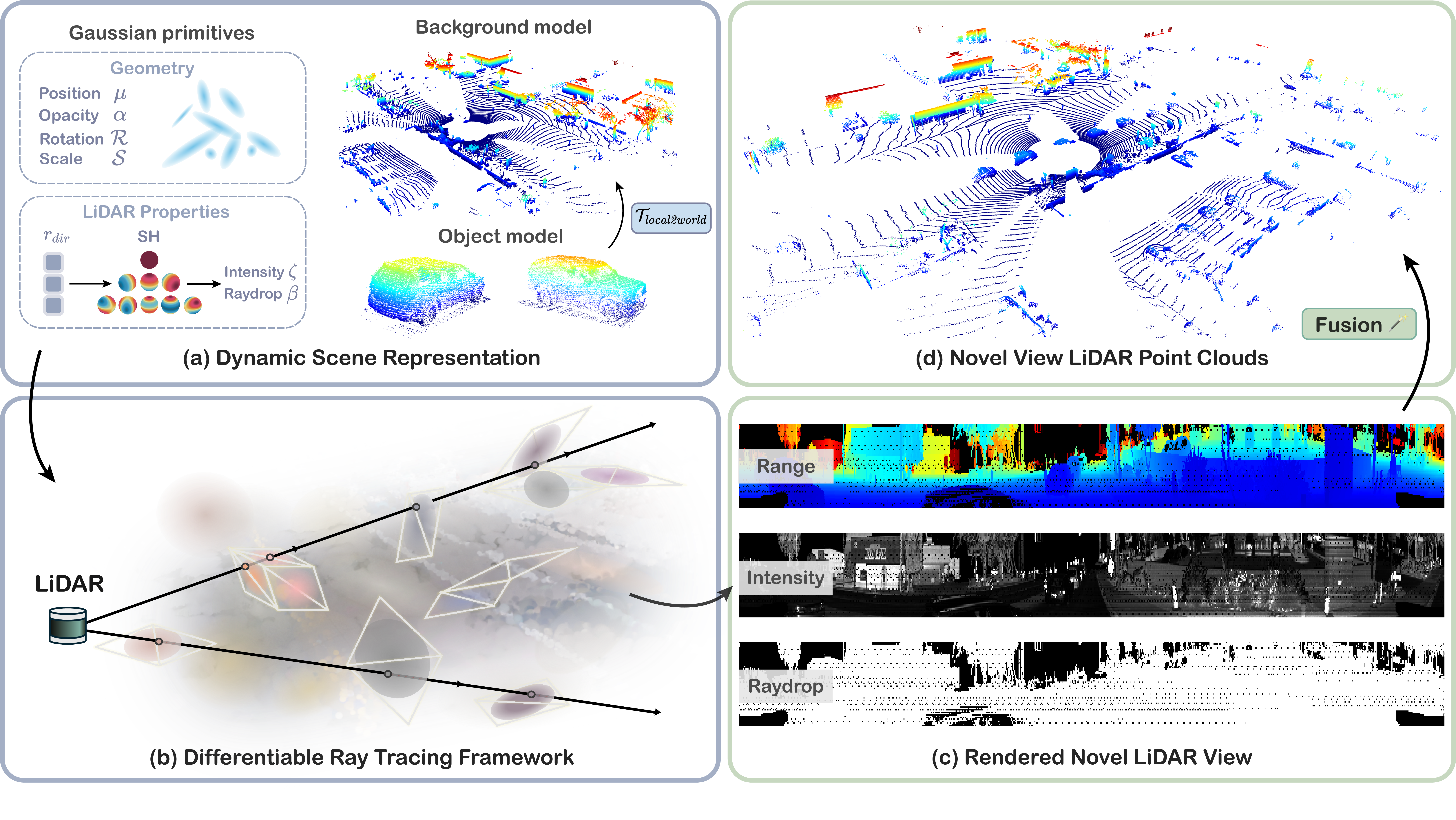
Pipeline overview. (a) We decompose the dynamic scene into a background model and multiple object models, with each represented by a set of Gaussian primitives. In addition to geometric attributes, we introduce learnable parameters (SHs) on Gaussians to emulate the intrinsic properties $(\zeta, \beta)$ of LiDAR sensors. (b) Based on this representation, we design a differentiable ray tracing framework. We first construct the proxy geometry for Gaussian primitives and then cast rays from the sensor to perform intersection tests. (c) By evaluating the response from these intersections, we accumulate point-wise properties along each ray, and finally render the novel LiDAR view as range images. (d) The range images are fused and re-projected into LiDAR point clouds for downstream tasks.

Comparison results


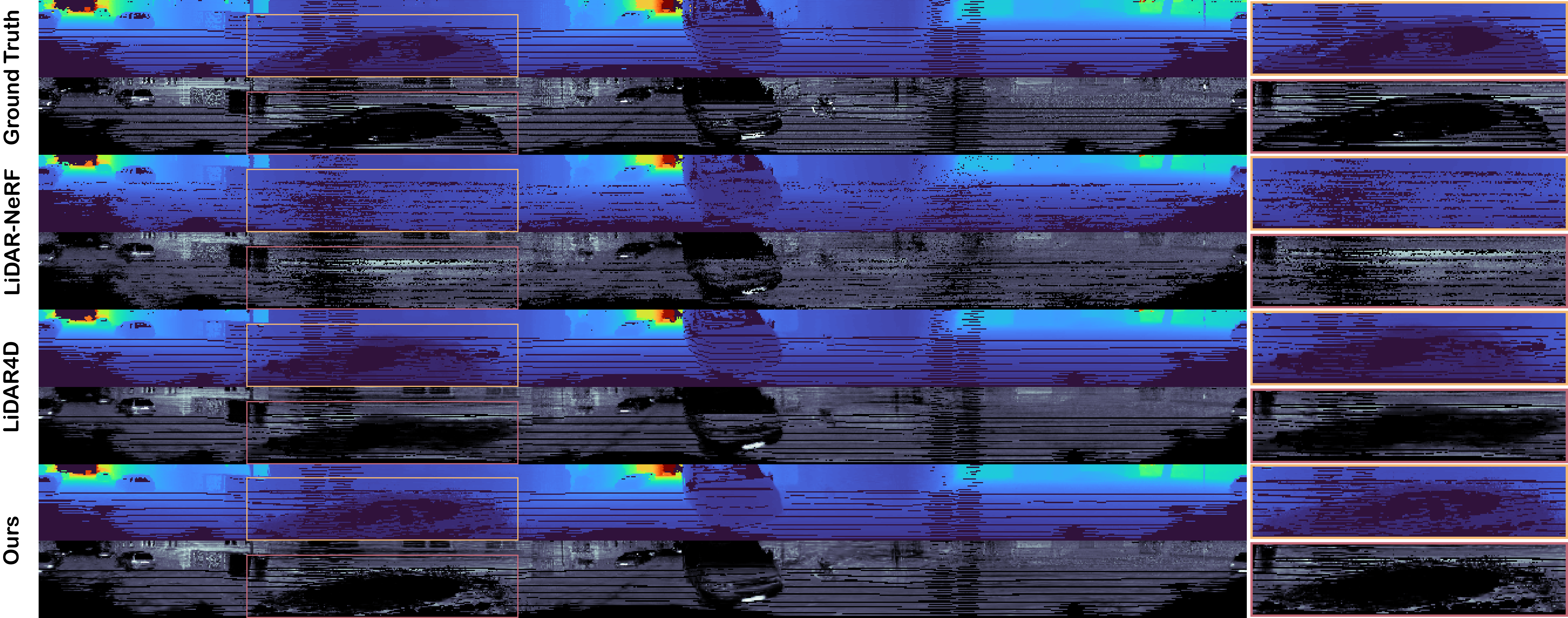
More comparison results on the dynamic scenes.

Depth

Ground Truth

Intensity

Ground Truth

More comparison results on the static scenes.

comparison results on the Waymo dataset

comparison results on the KITTI-360 dataset

Novel view LiDAR synthesis results


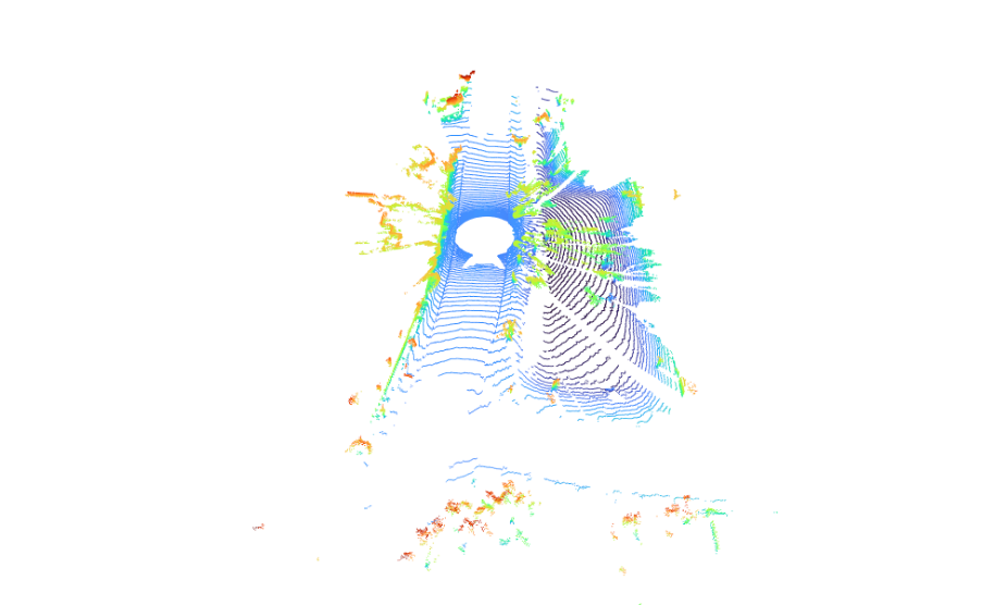
Novel view LiDAR point clouds


Novel view LiDAR range images(depth/intensity)


Applications


Dynamic editing results

Scene editing results

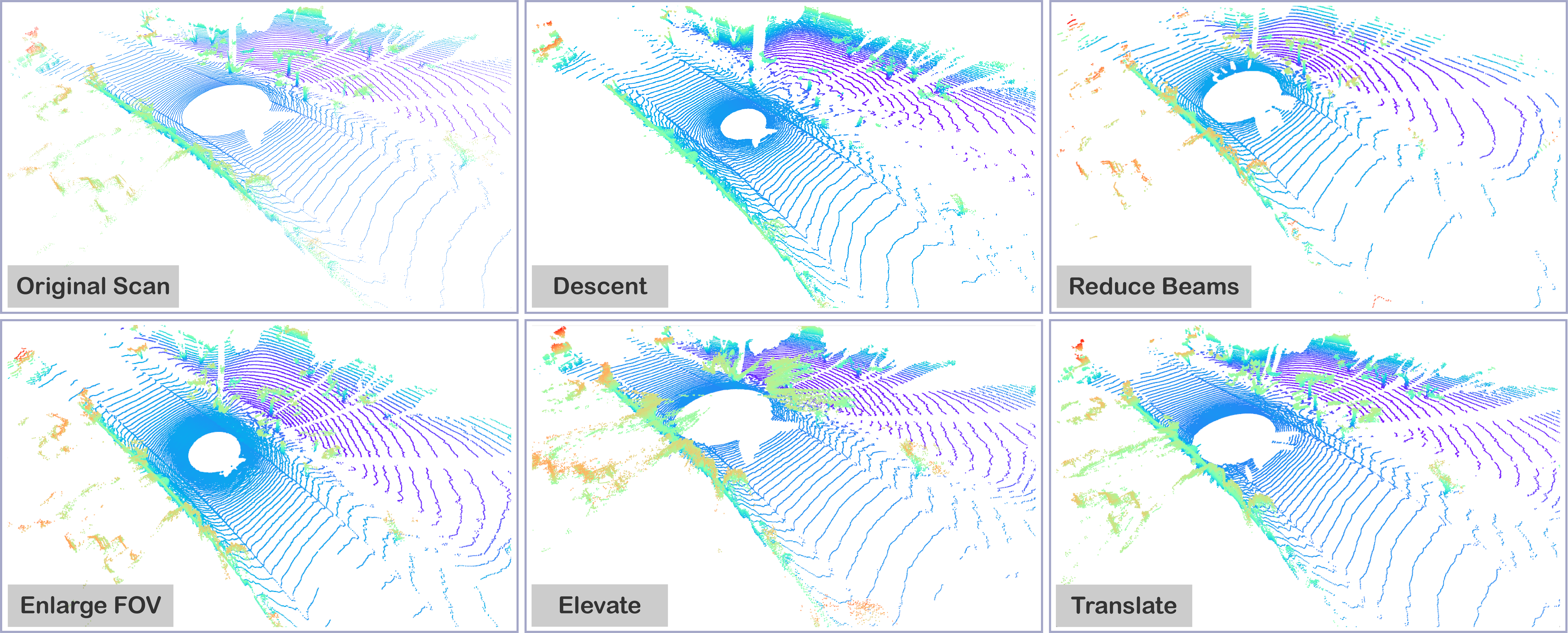
Sensor configuration results


Citation


@article{zhou2024lidarrt,
    title={{LiDAR-RT}: Gaussian-based Ray Tracing for Dynamic LiDAR Re-simulation},
    author={Zhou, Chenxu and Fu, Lvchang and Peng, Sida and Yan, Yunzhi and Zhang, Zhanhua and Chen, Yong and Xia, Jiazhi and Zhou, Xiaowei},
    journal={arXiv preprint arXiv:2412.15199},
    year={2024}
}